License information for Airline Traffic (Azimuthal Equidistant Projection)
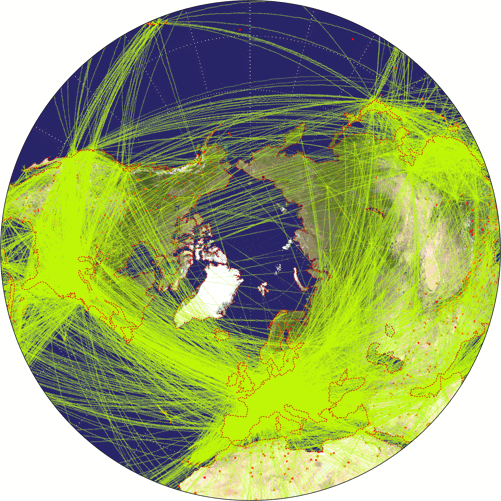
| Description | Airline traffic world map, projected to Azimuthal Equidistant Projection. | |||
|---|---|---|---|---|
| Size(s) | 501 × 501 | (126.37 KB, image/png) | Show (new window) | |
| 200 × 200 | (24 KB, image/png) | Show (new window) | ||
| License |
 Airline Traffic (Azimuthal Equidistant Projection) by Tobias Jung is licensed under a Creative Commons Attribution-ShareAlike 4.0 International License. Original image: World Airline Routemap 2009 by Jpatokal. Changes: Brightened the ocean color; highlighting the coastlines by a dotted line; projected to the azimuthal equidistant projection and truncated at 20° north. |
|||
Use this file in own projects
Downloading and using the image is allowed within the scope of the above-mentioned licence.
Please use the build-in functions of your web browser to download the image above.
To share the image, use the
single view.
The nifty little download function that used to be here (to download the image with a single click and to prevent file name conflicts with other images of the same projection) was removed due to heavy traffic caused by bulk downloads. Sorry!
Use this file on the web
Please respect the terms as stated in the CC BY-SA 4.0 License.
Whenever possible, please download the image to install it on your own website rather than using the
File URL given above to embed it.